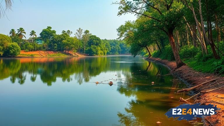
The Karnataka government has taken a major step towards restoring and conserving waterbodies in the state by geotagging over 31,000 waterbodies. This initiative is part of a larger effort to rejuvenate and protect the state’s water resources. The geotagging process involves assigning a unique identifier to each waterbody, allowing for easy tracking and monitoring of their condition. This data will be used to identify areas that require immediate attention and to develop targeted restoration plans. The Karnataka government has been working tirelessly to restore and conserve waterbodies, recognizing the critical role they play in maintaining the state’s ecosystem. Waterbodies are not only essential for irrigation and drinking water, but they also support a wide range of aquatic life and help to regulate the water cycle. However, many of Karnataka’s waterbodies have fallen into disrepair due to pollution, encroachment, and neglect. The geotagging initiative is a crucial step towards addressing these issues and ensuring the long-term sustainability of the state’s water resources. By geotagging waterbodies, the government can track changes in their condition over time and develop effective strategies for restoration and conservation. This data will also be used to engage with local communities and raise awareness about the importance of protecting waterbodies. The Karnataka government has already begun to implement restoration plans for many of the geotagged waterbodies, including desilting, dredging, and the removal of invasive species. These efforts are expected to have a significant impact on the state’s ecosystem, improving water quality, increasing biodiversity, and enhancing the overall health of the environment. The geotagging initiative is also expected to support the state’s agricultural sector, which relies heavily on waterbodies for irrigation. By restoring and conserving waterbodies, the government aims to improve crop yields, increase farmer incomes, and enhance food security. The success of the geotagging initiative has significant implications for other states in India, which are also struggling to restore and conserve their waterbodies. The Karnataka government’s approach provides a model for other states to follow, demonstrating the importance of data-driven decision making and community engagement in waterbody restoration efforts. As the Indian government continues to prioritize water conservation and sustainability, the geotagging initiative in Karnataka is an important step towards achieving these goals. The initiative also highlights the critical role that technology can play in supporting environmental conservation efforts. By leveraging geospatial technology, the Karnataka government has been able to efficiently and effectively track and monitor the state’s waterbodies, allowing for targeted interventions and improved outcomes. The geotagging initiative is a testament to the government’s commitment to protecting the environment and ensuring the long-term sustainability of the state’s water resources. With the geotagging process complete, the government is now focused on implementing restoration plans and engaging with local communities to raise awareness about the importance of waterbody conservation. The success of the initiative will be closely monitored, with regular assessments and evaluations to ensure that the desired outcomes are being achieved. Overall, the geotagging of over 31,000 waterbodies in Karnataka is a significant achievement, demonstrating the government’s commitment to environmental conservation and sustainability. The initiative has the potential to make a lasting impact on the state’s ecosystem, supporting biodiversity, improving water quality, and enhancing the overall health of the environment.