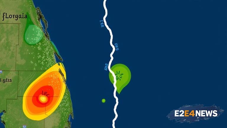
A significant weather pattern is unfolding in Central Florida, as a front is forecasted to move into the region, effectively dividing it into two distinct areas with varying rain chances. This development is expected to have a profound impact on the local weather, with some areas experiencing increased precipitation while others remain relatively dry. The front, which is currently moving eastward, is anticipated to stall over the region, leading to a prolonged period of unsettled weather. As a result, residents and visitors alike can expect a mixed bag of weather conditions, ranging from sunny skies to heavy downpours. The areas north of Orlando are likely to experience the highest rain chances, with some locations potentially seeing upwards of 2-3 inches of rainfall. In contrast, areas south of Orlando may remain relatively dry, with only isolated showers and thunderstorms expected. The reason for this divide lies in the positioning of the front, which will act as a focal point for moisture and instability in the atmosphere. As the front interacts with the surrounding air masses, it will force warm, moist air to rise, cool, and condense, resulting in the formation of clouds and precipitation. The resulting rain showers and thunderstorms will be most pronounced in areas where the front is most active, leading to a significant increase in rain chances. However, areas that remain south of the front will be influenced by a drier air mass, leading to a decrease in precipitation chances. The timing of the front’s arrival will also play a crucial role in determining the overall weather pattern, with the morning and early afternoon hours expected to be the wettest. As the day wears on, the rain chances will gradually decrease, giving way to partly cloudy skies and mild temperatures. Despite the uncertainty surrounding the front’s exact track and timing, one thing is clear: Central Florida is in for a wild ride, weather-wise. Residents and visitors are advised to stay tuned to local weather forecasts and warnings, as the situation continues to evolve. The National Weather Service has issued a statement highlighting the potential for heavy rainfall and isolated thunderstorms, and residents are urged to take necessary precautions to ensure their safety. In addition to the rain, the front will also bring a significant drop in temperatures, with daytime highs struggling to reach the mid-70s in some areas. The cooler temperatures will be a welcome relief for many, especially after the recent heatwave that gripped the region. However, the cooler air will also lead to an increase in wind speeds, making it feel even chillier than the actual temperature. As the front continues to move through the region, it will leave behind a trail of cooler, drier air, setting the stage for a pleasant weekend. But before that, residents will have to navigate the unpredictable weather pattern, which will be characterized by sudden changes in precipitation and temperature. The good news is that the front will eventually move out of the region, paving the way for a return to more seasonal weather. Until then, residents and visitors will have to be prepared for a wide range of weather conditions, from heavy rain to sunny skies. The Central Florida weather divide is a reminder that the region’s weather can be notoriously unpredictable, and it’s essential to stay informed and up-to-date with the latest forecasts and warnings.